Fly to Save the Earth
An army of volunteer pilots helps conservationists survey an endangered planet.
/https://tf-cmsv2-smithsonianmag-media.s3.amazonaws.com/filer/36/9c/369c56c5-1888-4e27-ac3a-12fffb9b0438/03l_dj2016_aerialbaja1357884pacificcoastworthington_live-web-resize.jpg)
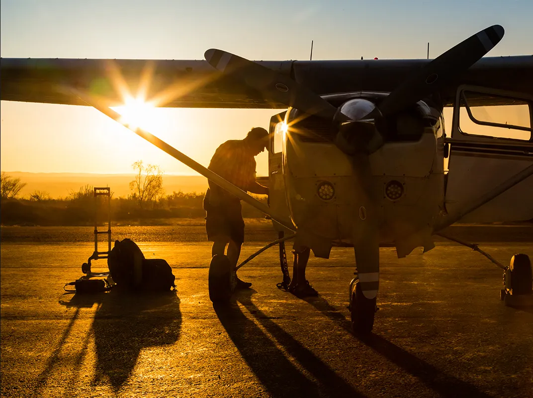
“Problemo,” said Lawrence “Bud” Sittig, gesturing at the amber light that had blinked on in the Cessna 206. It was April 2014, and he was flying four scientists from Guatemala’s National Council of Protected Areas, including one taking photos out an open door, over the jungles of the Peten region. They spoke no English, and Sittig speaks only a little Spanish.
“No problemo,” they answered, thinking the pilot was asking if they had a problem.
“No,” Sittig said again, with a little more emphasis as he pointed to the dashboard light telling him that the airplane had suffered a complete electrical failure. “Problemo!” He made a circle in the air with his finger. Sittig saw his message got through; the men began to cross themselves for protection as he turned the Cessna to head back to the airport at Tikal.
Sittig is one of over 220 pilots who volunteer with LightHawk, a nonprofit organization that provides free flights to conservation groups throughout North and Central America. Founded by bush pilot Michael Stewart in 1979, the group began with a single mission: to help activists stop the proposed building of a coal-fired power plant on the edge of the Grand Canyon. The environmentalists argued that pollution would ruin the views of the national park, so Stewart recruited four airplanes and three pilots to take up television crews and show them exactly what would be obscured. (The plant was not built.) Over the last 36 years, the organization has recruited hundreds more pilots to fly conservationists working to save forests, watersheds, endangered animals, and other parts of the natural world.
LightHawk’s work often sends the pilots on difficult flights over diverse terrain, requiring them to visually navigate around specific sites on the ground. The missions have time and logistical constraints, and the places conservationists and scientists need access to are frequently in remote areas or over open water, with no secondary airports for emergency landings in range. To ensure both mission success and passenger safety, LightHawk sets a high standard for its pilots: Among other qualifications, they must have a minimum 1,000 hours flying time, compared to 250 for most volunteer aviation organizations, which generally offer only transportation.
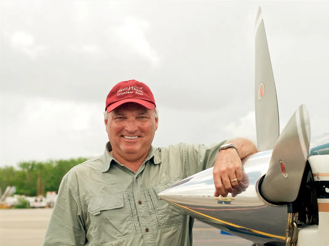
Sittig is up for the challenge. He began his career in the Air National Guard flying F-100s, A-7s, and F-16s before logging tens of thousands of hours as a captain for Delta Airlines, where he also served as director of flight safety before retiring in 2004. These days, in addition to his time with LightHawk, he flies the B-17 Memphis Belle around the country for the Liberty Foundation. (He was the co-pilot of the Liberty Belle when it suffered an inflight fire in 2011; Sittig set the airplane down in a field in Illinois and got all seven passengers out safely before the fire destroyed the aircraft.) That’s the kind of experience LightHawk likes; when his six-seat Cessna encountered a problem over the jungle, Sittig didn’t panic. “To lose electrical power on these single-engine planes is not a critical emergency,” Sittig says. “They fly just fine, but you do lose navigation and radio. You’re back to the way we flew in the ’30s and ’40s.” He made the landing safely, dropped off his passengers, and contacted the international airport in Guatemala City, where he’d need to go for repairs. “For a light airplane to come in there and sequence himself in with the airliners without a radio can be challenging,” says Sittig. He gave the airport a precise arrival time, set a compass heading, and flew 150 miles over the 11,000-foot central Guatemalan mountains, landing at the airport right on time. After the airplane was repaired, Sittig flew back to Tikal to pick up the scientists and complete the three-week mission: observing how the Peten jungles are being deforested and encroached upon.
LightHawk asks that its volunteers bring a lot more than skill. For flights over North America, pilots use their own aircraft and absorb the cost of fuel, insurance, and hangaring the airplanes during a mission. The organization owns only a Cessna 182 and a 206, used mostly for flights in Mexico and Central America so that the volunteers won’t have to deal with permitting their own aircraft. When a conservation group approaches LightHawk for aerial support, an email blast goes out to volunteers in the region with a description of the project and a flight plan, along with the local airport and how many days it will take. After making a commitment to the mission, a pilot usually has a week or two to study the logistics.
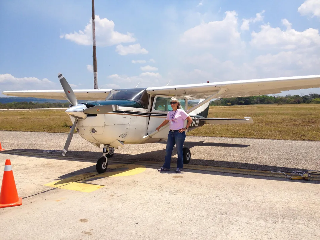
Volunteer pilot Stephanie Wells does have her own airplane, but it’s a two-seater Van’s RV-7 kitplane, so she bought a quarter share of a Cessna 182 to fly for LightHawk missions in the United States. Wells brings another impressive résumé to the organization: The retired U.S. Air Force pilot flew WC-130s, several times through typhoons in Guam. She also flew a C-5 Galaxy in support of the 1993 Battle of Mogadishu in Somalia, better known in its 2001 movie form as Black Hawk Down. Then she spent nearly two decades flying for NASA, including the “Vomit Comet,” the parabola-flying KC-135A used for zero-gravity training. “Now I get to do the fun stuff,” Wells said to herself when she retired from professional flying. “And one of the things I have always wanted to do was combine my passions and capabilities as a pilot with environmental issues.” Since joining LightHawk in 2012, Wells has flown missions in the United States, Costa Rica, Belize, Guatemala, and Panama.
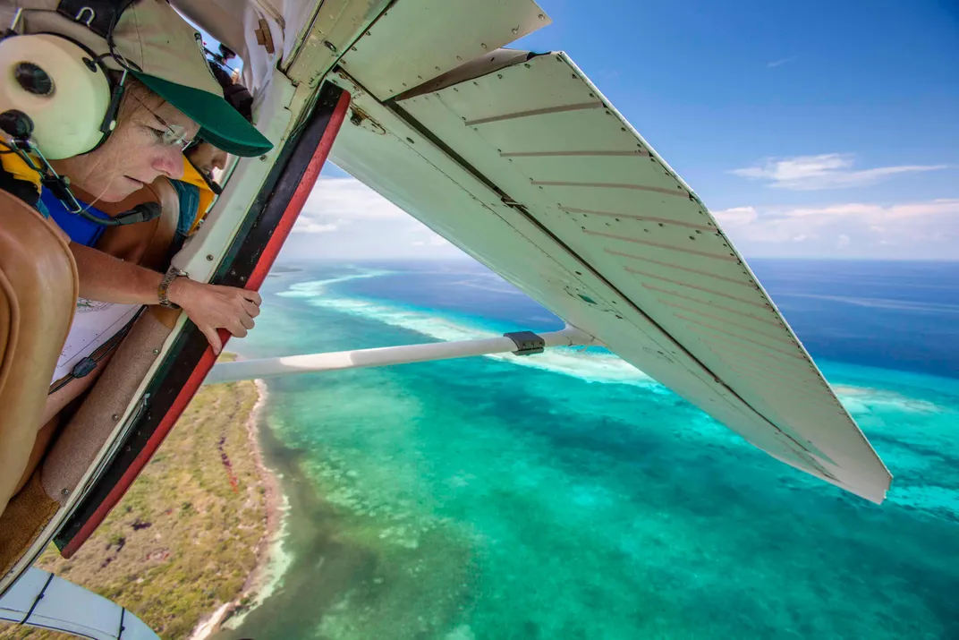
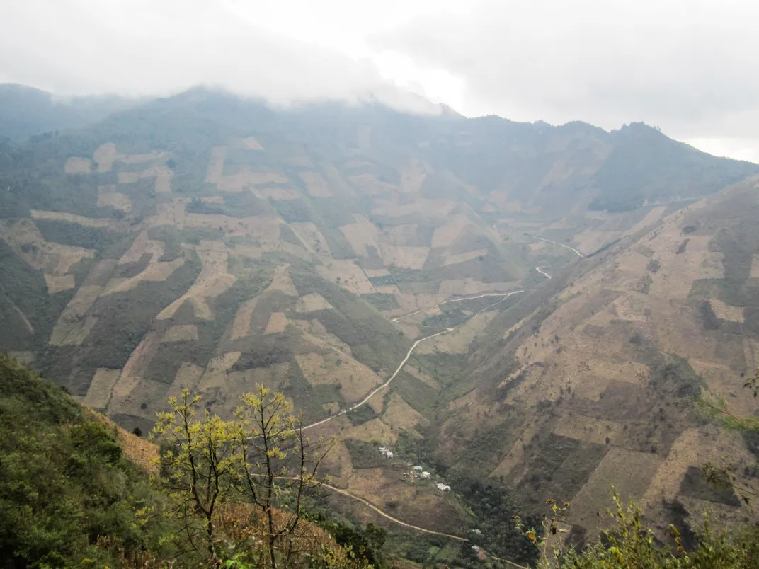
On a trip in March 2014, Wells flew to Guatemala for a two-week assignment she says she was able to squeeze “in between a Nicaragua vacation and my karate green belt test.” The local branch of the Wildlife Conservation Society, which tracks changes in land use, deforestation, and the types of forests and ecosystems remaining, wanted to map the entire country. Although the group collects satellite images, LightHawk flights enabled it to get a much closer view, greatly improving its ability to monitor Guatemala’s natural resources. Wells flew LightHawk’s Cessna 206, tail number 7917N, on 10 flights over eight days, logging 38 hours of flying. It was terrifically hot, and the intentional burning of the fields below made the visibility poor. Rain clouds often hid the high mountain peaks. “I actually got the old 17N up to 13,500 [feet],” Wells wrote in her flight journal. “Getting the 17N to climb is hard…. I’m often looking at only 100–200 feet per minute climb, and sink in the sinking air. For this mission it’s very valuable to have some mountain flying experience—which I have some, but not a lot. Now I have more.”
LightHawk trusts its experienced pilots to say no when the situation requires it. Wells handled most of the poor weather during that 2014 mission, but chose to abort one of the flights. Sittig mostly takes missions near the Rocky Mountains, where air density and turbulence can cause major trouble for small passenger airplanes. “There’s always an abundance of caution,” he says. “I have declined a specific mission profile because the elevation was too high to safely or comfortably operate.” When that happens, the pilots negotiate with the partners to find alternate flight paths that will accomplish their goals safely.
This year, LightHawk missions have helped a marine research group at the University of British Columbia collect data for a system to connect western Canadian coastal communities vulnerable to flooding, enabled the Institute of Ecology in Mexico to count the members of the last wild herd of Mexican pronghorn (the group is working with local ranchers to prevent the animals’ extinction), flew with Santa Barbara Channelkeeper to evaluate the cleanup of the May 19 oil pipeline spill off of Refugio State Beach in southern California, and enabled environmentalists in Michigan to take imagery of Lake Erie. The images were presented to U.S. Representative Marcy Kaptur of Toledo, Ohio, who is now pushing for a regional water authority similar to a Chesapeake Bay program created in 2009. That list of projects is representative of the nearly 350 missions LightHawk has flown in 10 countries with more than 80 conservation organizations in the last 12 months.
Though the group’s missions are numerous and varied, it’s difficult to pin down the efficacy of its work. That’s because LightHawk provides the assists, says Rudy Engholm, who has been a volunteer pilot since 2003 and served as executive director for seven years, until 2014. “LightHawk is in the business of supporting the frontline groups that actually do the conservation on the ground,” he says. The view from the air can provide an epiphany to legislative decision makers, media, and even the conservation scientists. “All the time we hear our passengers say, ‘I had no idea,’ ” says Engholm. “You can see shorelines, rivers, how big a forest is. A few years ago I flew over the [area proposed for the] Maine Woods National Park, 3.2 million acres. Nobody is born knowing what a million acres looks like.” And despite the technology that has proliferated in the last three decades—satellite and Google Earth images are available to anyone online—there’s still a need for what LightHawk provides. “I flew over the Alberta tar sands a few years ago,” says Engholm, of the crude oil excavation in central Canada, “and it’s a very powerful experience to see [34 million acres] just [chewed] up. And yet you look at that thing on Google Earth and it looks like some light patches…. It doesn’t hit your gut in the same way.” He sees the easy access to technology working in tandem with LightHawk; satellite imagery is useful, but it needs the infusion of in-person views from the air.
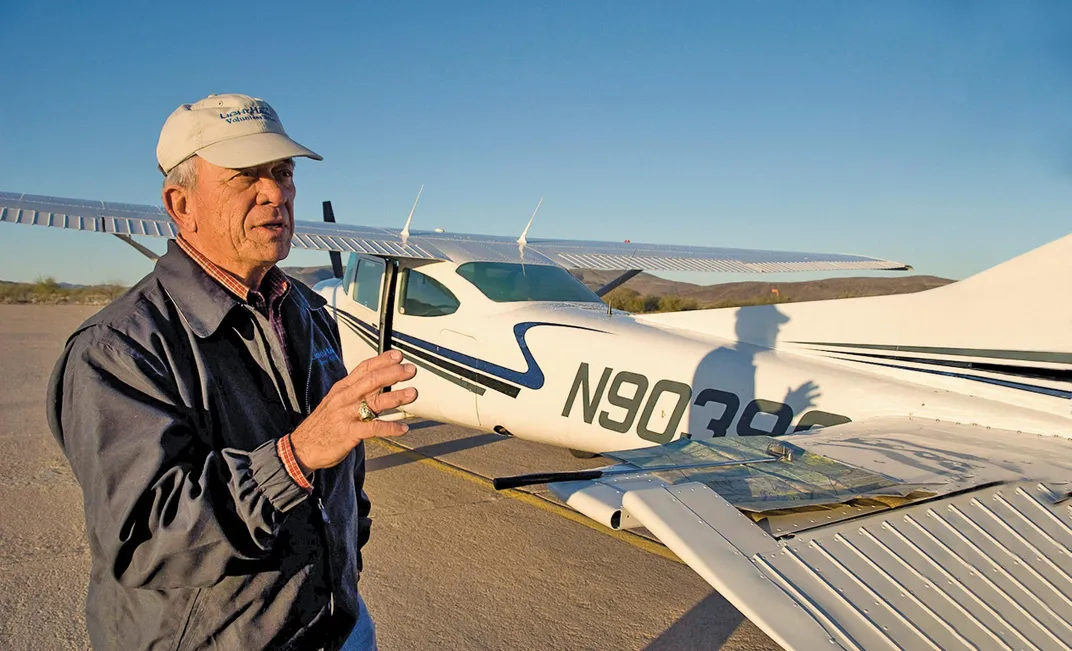
Sometimes the view from the air can have a profound effect on the volunteer pilot too. In 1978, Will Worthington transferred from the Army Corps of Engineers to the U.S. Bureau of Reclamation, where he worked as chief civil engineer of the Central Arizona Project, building dams and a pipeline to transport water from the Colorado River to the inland cities, one of many diversions Western states have built along the 1,450-mile river to obtain a share of its flow. Worthington never thought about how diverting the water was affecting anyone downriver. By 1992, when the aqueduct was essentially complete, the last 100 miles of river that flowed from the Morelos Dam on the U.S.-Mexico border down to the Colorado Delta in Baja California had almost completely dried up; after 1999, the river would need intervention to ever reach the Gulf of California again.
In 2005, Worthington joined LightHawk and soon got a clear picture of the impact humans had made on the river. The Sonoran Institute, a nonprofit conservation group based in Tucson, Arizona, asked LightHawk to partner with it on a program to get water flowing back down through Mexico. When Worthington accepted one of its missions and saw the lower part of the Colorado for the first time, it hit him. “It was just dead,” he says. “I didn’t feel responsible, but I hoped somehow I could help correct this tragic oversight that we—that society—had made.” Still, he couldn’t imagine how it could be done. “I didn’t think initially that they had a chance to do what they said they wanted to do,” he says. “I knew how much work it was to [divert the water], and I thought the reverse would be more than they appreciated.” In the beginning LightHawk was flying only a few Sonoran Institute scientists, Worthington says. “But pretty soon on our flights we had their board of directors, donors and prospective donors, local, national, and international media, universities, government bureaucrats, elected officials, and other conservation organizations, all giving their support.”
In November 2012, after years of Sonoran’s work, facilitated by LightHawk flyovers that drove home the extent of damage to the river basin—and the potential for fixing it—a historic agreement was reached between the United States and Mexico to promote the health and extend the flow of the river. In March 2014, the gates of the Morelos Dam were lifted to allow a “pulse flow” of 105,000 acre-feet of water down the basin. Eight weeks later, the Colorado River reached the Gulf of California for the first time in 15 years. “There is an amazing reaction we get from people who go on the flights,” says Francisco Zamora, director of the Sonoran Institute program to restore the Colorado Delta. “They see the entire delta and the magnitude of deterioration. And then they get to see what we have been able to do with our active restoration areas. It is only from the air that you can get that sense of connectivity.”
The partnership hasn’t ended there. “LightHawk is a critical component of what we do,” says Seth Cothrun, director of marketing, corporate, and foundation relations for the Sonoran Institute. “During the pulse flow they were instrumental to give us almost daily support, monitoring, and mapping” of how the water was flowing from the border to the delta. The conservationists plan to keep working with the pilots for at least the next few years; the current Colorado River agreement is set to expire in 2017. Lucky for the people who live near the Colorado Delta, hundreds of pilots are on call, ready to change the way humans view their planet.