California’s Snow Sentinel
When all your water is in the snowpack, you better keep your eyes on the mountaintops.
/https://tf-cmsv2-smithsonianmag-media.s3.amazonaws.com/filer/1d/d7/1dd7bd68-46a4-47d0-bcb4-5f89e3fa0691/07a_dj2017_asoaircraftinflight_live.jpg)
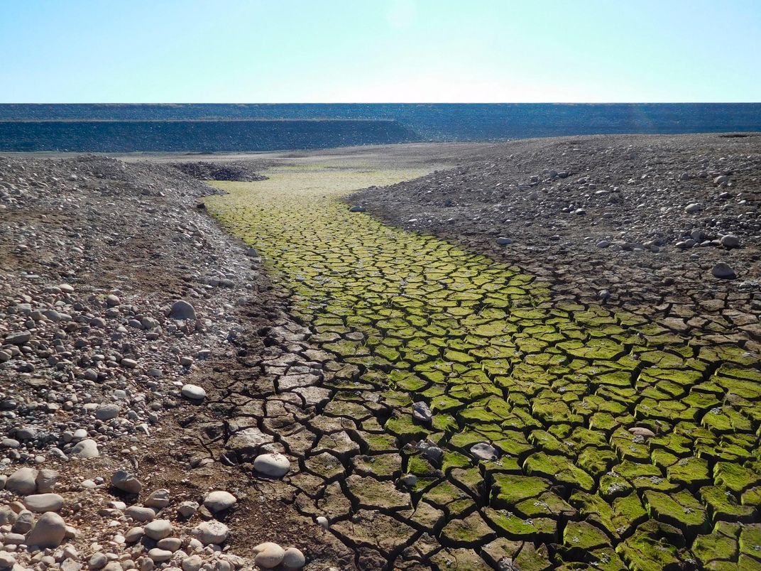
Governor Jerry Brown’s hiking boots were dry as he stood in a grassy meadow 6,800 feet high in California’s Sierra Nevada mountains. He should have been buried up to his eyeballs in snow at that time of year—near the end of the spring storm season. But 2015 was the worst year yet for the state’s ongoing drought, and for the first time in 75 years, the ground at this snow-measuring station was bare on April 1.
Because the state’s overall snowpack contained a fraction of its usual water content, Brown ordered California to slash its water usage by one-quarter. It was the latest in a series of desperate measures to try to curtail the use of water the state simply did not have.
One year later, thanks to stronger winter storms, the picture was slightly less grim. The meadow where Brown had stood was covered with nearly five feet of snow, and the statewide snowpack was up to 87 percent of average. But California remains in its sixth year of drought, and everyone from almond farmers in the Central Valley to movie stars in Beverly Hills is feeling the thirst.
Now, help is coming in the form of a King Air A90. Scientists have loaded the airplane with instruments to study California’s snowpack in unprecedented detail. Each spring, they fly back and forth over the mountain ranges, measuring where the snow lies and how deep it is. That information helps water managers plan for exactly how much snowmelt to expect rushing downstream each spring—and, in turn, how to divvy up those scarce gallons among the people who need it the most. The airplane can’t make more snow fall from the sky, but it can help officials make smarter decisions about how to use what’s already there.

Subscribe to Air & Space Magazine Now
This story is a selection from the January issue of Air & Space magazine
The idea for the mission arose in the late 2000s, before the current drought really took hold of California. Thomas Painter, a snow hydrologist who was then at the University of Utah, attended a colleague’s talk about using an airplane with a laser to measure tropical forest loss. Scientists aboard that airplane shot lasers down to the ground and measured how quickly the pulses returned, and the results made a three-dimensional picture of the landscape. Returning to the same spot time after time enabled them to study how quickly loggers were stripping trees away.
Not long after the talk, NASA’s Jet Propulsion Laboratory in Pasadena, California, recruited Painter to study water resources and climate science, and he thought back to how that laser technique might be used to study snow levels. He called Frank Gehrke, chief of snow surveys for the California Department of Water Resources in Sacramento, and asked if he wanted to know more about imaging the state’s snowpack from the air. In 2012, the Airborne Snow Observatory took off on its first mountain pass.
The observatory measures snow depth by first flying over a mountain range in the summer when it is free of snow to create a baseline. The aircraft’s commercially built lidar system—a laser system that works like radar—sends two beams toward the surface, one that starts out pointed slightly forward and the other aft, each scanning back and forth for complete coverage of the ground below. By analyzing the light that bounces off the surface and back toward the airplane, researchers can measure distances to within four inches—sometimes even more precisely—building up a three-dimensional portrait of the ground beneath. When the airplane returns to the same region during winter, it measures down to the top of the snow levels. Comparing the two data maps shows snow depth across the entire landscape. (Using lidar in a satellite is still experimental: It’s not yet able to collect as much surface data as an airplane because it passes over the area of study much more quickly and much less frequently than an airplane can.)
In addition to snow depth, the observatory measures the reflectivity of the snow, also known as albedo. As winter transitions into spring, snow gets darker, because melting on top causes the grains to become rounder and clump together, and because soot, dust and other contaminants blow onto it. A spectrometer determines the snow’s color, which tells researchers how long it’s likely to stick around. If the snow melts more quickly than average, says Megan Richardson, who heads up the snow-observing project, reservoir managers “need to make decisions about how much water to release downstream, generating hydroelectric energy whenever possible, while ensuring the safety of the dam and maintaining water reserves.”
The first Airborne Snow Observatory, which carried both the lidar and the spectrometer, was a de Havilland Canada Twin Otter. Eventually the team swapped the de Havilland for a Beech King Air A90, which can fly higher and faster, so it can cover more area more quickly. Project managers lease the airplane and hire pilots from Dynamic Aviation of Bridgewater, Virginia, moving them to Mammoth Lakes in California during mission runs.
Flying the snow survey requires the airplane to stay at a near-constant speed with its wings level while navigating through the challenging wind and weather above the mountains. At the end of each survey line, pilots bank the airplane around for the next pass. “There’s a considerable amount of skill involved on the part of the pilots in making sure those turns are as efficient as possible,” Gehrke says. Pilots using the King Air were able to reduce turn times from five minutes to two. In a survey that requires two dozen passes, that saved 90 minutes of flight time and a stop for refueling.
The observatory flies primarily from late March through early July, when western snowpacks are getting their last dumps from winter storms and beginning to move into melt season. “We take a terabyte of data off the plane each time we fly, and we turn [that data] around in 24 hours,” says Kat Bormann, a postdoctoral fellow at JPL and member of the observatory’s science team. “That’s the really exciting thing—the water managers get an overview of how much water is up there from the day before.”
No one realized at the outset that the mission would be flying during California’s worst drought in decades. It began in 2013, surveying snow in the Tuolumne River watershed, which supplies the city of San Francisco. That year it measured 287,000 acre-feet of water bound up in the mountain snow. The following year saw a 46 percent drop. By 2015, the year the governor stood in a snow-free meadow, the water was down to an astonishing 57,000 acre-feet, the airborne observatory measurements showed.
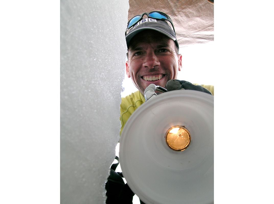
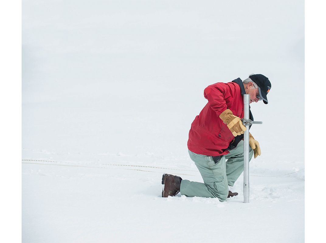
There was so little snow that traditional methods for assessing the state’s snowpack basically stopped working. For decades, snow surveyors have fanned out into the mountains to measure snow depth with poles or snow pillows, which are like large inflatable mattresses that measure the weight of accumulating snow. But neither method works when the snowpack shrinks so radically that it forms only at extremely high elevations, beyond the reach of the surveyors. “After that, you no longer know what’s going on in the watershed,” says Gehrke.
That’s exactly what happened in 2015. There was so little snow that even the observatory had relatively little to do. In previous years, “as the snow starts to recede, we can usually cut some lines out of the survey,” says Richardson, referring to the passes the aircraft makes during its flight. In 2015, she says, they started the season without those lines.

Drought has affected every aspect of life in the Golden State. It cost farmers roughly $2.7 billion in 2015 alone—in part to pump dwindling groundwater supplies to make up for the lack of river water. Hydro-power facilities are producing less electricity, so the state has had to compensate by ramping up solar, natural gas, and other energy sources. And California’s natural ecosystems are suffering: The low river flows are interrupting the seasonal runs and egg-laying of native fish, so their populations have dropped dramatically.
In such dry times, water managers are signing up in droves to receive data from the snow observatory flights. The San Francisco Public Utilities Commission uses the information to improve its predictions of how much water is flowing into the Hetch Hetchy reservoir, the city’s main source of drinking water. With the snow observatory’s data, officials can now estimate the minimum expected inflow within two percent. When they were using just the data from snow surveys and snow pillows, those uncertainties could range as high as 40 percent, Painter says. Water managers pass along this information to farmers to help them plan for the year and anticipate decisions, such as whether they may need to pay to pump additional groundwater in the coming summer or whether they might want to let some of their fields lay fallow. “It boils down to peace of mind,” says Jeffrey Deems, a snow scientist at the National Snow and Ice Data Center in Boulder, Colorado. “[Water managers] know how much snow is up there and they can watch it melting out. They can be confident they have a full picture of the snowpack, rather than worrying there’s something they’re missing with incomplete measurements.”
Other California cities and water-reliant companies, like Southern California Edison, have signed up to get snow observatory data. Partners share in the $1.5 to $2 million annual cost, the bulk of which is currently borne by NASA.
Heavy snows in the 2015-2016 winter season have mitigated some of the drought, but experts warn that the state is not yet out of danger. And now that the observatory’s water data is in such high demand, when the King Air begins its California survey again this spring, the state’s mountains will be just one of the observatory’s ever-increasing list of targets.
The airplane already flies regularly over western Colorado’s Uncompaghre basin. Its meltwater runs into the Colorado River, a crucial water source throughout the American Southwest. In fact, demand for measurements is so high that project managers are considering adding a second aircraft. That would help solve the mission’s biggest constraint: the sheer time involved in moving the airplane among all the geographical areas that want snow mapping. Utah, Oregon, Wyoming, Washington, and Idaho are getting involved, complicating the logistics of where to fly when. “To reduce transit time, maybe we could have a plane in the Sierra Nevada and another in Colorado,” Bormann says. “We’re adding new basins every year; it’s scary and exciting at the same time.”
Eventually, the airborne observatory will help water managers all over the West make detailed plans for each year’s needs, and better understand how climate changes affect the snowpack. Knowing how the snow varies from year to year—and what factors drive those changes—is vital for understanding future shifts, says Brian Henn, a postdoc at the Scripps Institution of Oceanography in San Diego.
Henn has been using the Airborne Snow Observatory to look at patterns of precipitation in mountain watersheds, such as how much falls as rain and how much falls as snow. “If you want to say what’s going to happen to precipitation over the Sierra Nevada in the future, you need a pretty good representation of what’s happening right now,” he says.
“We need to know how much snow there is,” says Jessica Lundquist, a hydrologist at the University of Washington in Seattle. “This is the most dynamically changing part of the globe right now. We need to get this right.” Because what happens in California doesn’t just stay in California. Lessons from its ongoing drought can apply to other mountain ranges around the world, where more than a billion people depend on snow and glaciers for their water supply.