“That’s Professor Global Hawk”
A remote-piloted warrior starts flying for science.
/https://tf-cmsv2-smithsonianmag-media.s3.amazonaws.com/filer/Thats_professor_global_hawk_2_FLASH.jpg)
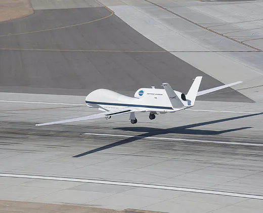
On an April morning last year beneath a bright desert sky, officials at NASA’s Dryden Flight Research Center in California unveiled their newest tool for studying the atmosphere: a Global Hawk. In fact, it was the very first Global Hawk, produced in 1998 as a demonstrator to show the capabilities of the unmanned military airplane.
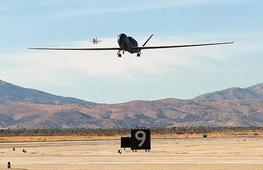
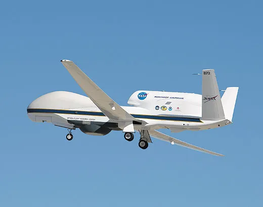
Originally developed to provide field commanders with high-resolution surveillance imagery and produced by Northrop Grumman, Global Hawks fly high and long. They reach altitudes of 65,000 feet, and can surpass 30 hours and 11,000 nautical miles in a single flight. For Earth scientists, loading a Global Hawk up with sampling gear and sending it into the stratosphere suggests intriguing applications: measuring levels of pollutants and greenhouse gases like ozone; studying the formation of hurricanes and the shrinkage of ice sheets; monitoring the effects of natural disasters. “Northrop Grumman and the U.S. Air Force have proved that you can use this plane to do reconnaissance,” says NASA atmospheric scientist Paul Newman, who helped oversee Global Hawk’s first climate research mission. “Well, science is just a different kind of reconnaissance.”
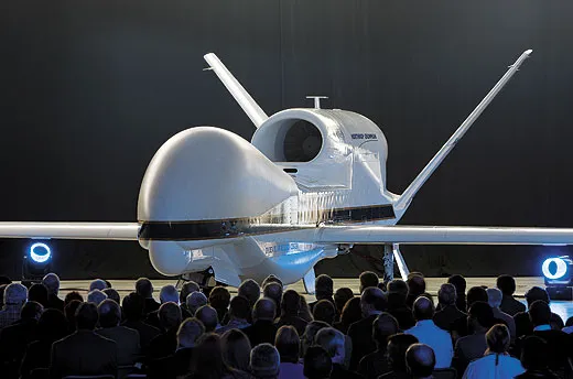
The Global Hawk is no diminutive drone—its slender wings span 116 feet, and its V-tail reaches 15 feet high. With its white paint job, snub nose, humped radome, and single Rolls-Royce AE-3007H turbofan engine, the Global Hawk cuts a figure both elegant and strange; its profile gives the vague impression of a beluga wearing a jetpack.
Global Hawks are well established as military aircraft: The Air Force has deployed them since 2001; 30 have been built and 26 remain operational. But last April marked the first time a Global Hawk had been used for Earth science. As scientists and NASA officials gathered inside a Dryden hangar to admire Air Vehicle-1, the first Global Hawk made, its sister airplane, AV-6, was heading up the Pacific Northwest coast on a 24-hour tour, one of five flights planned as part of the Global Hawk Pacific (GloPac) mission, a joint effort between NASA and the National Oceanic and Atmospheric Administration to demonstrate the aircraft’s scientific utility.
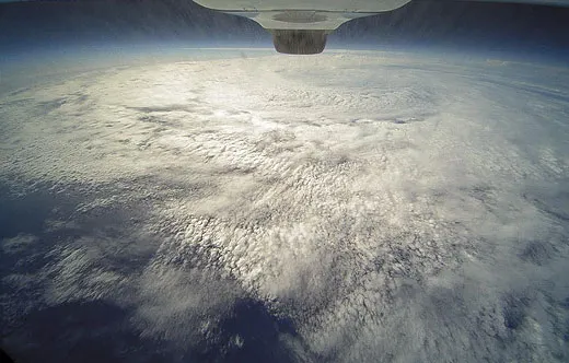
NOAA commander Phil Hall was at the controls that day, although nowhere near the aircraft itself. Clad in a khaki flightsuit, he was controlling the airplane from inside a ground station housed in an ordinary-looking office building at Dryden. Using mouse and keyboard, he guided the Global Hawk on a path that would take it from off the Alaskan coast to near Hawaii. Along the way, the aircraft underflew a tracking satellite to calibrate instruments with it, sampled a chunk of polar air to measure its ozone content, and intercepted a dust plume drifting across the ocean from Asia.
A few months later, Hall was back on the team for another Global Hawk first: its maiden hurricane surveillance mission. Part of NASA’s Genesis and Rapid Intensification Processes (GRIP) experiment, the unmanned airplane was deployed during the August-September hurricane season to help scientists better understand the formation and behavior of these fierce storms.
Says Hall: “We’re doing a lot of things with the airplane that have never been done before.”
For many Earth science researchers, the moment they saw a Global Hawk, it was love at first sight.
Newman, who is normally based at NASA’s Goddard Space Flight Center in Maryland, first glimpsed a Global Hawk in 1999; he was at Dryden preparing one of the agency’s ER-2s for an ozone depletion study, and a group of scientists were invited across the runway to look at one. “Boy, were we wowed,” he recalls.
Researchers immediately grasped the promise. “With any conventional aircraft, it always seems that the phenomena you’re interested in sampling—a hurricane or the polar vortex up in the Arctic—is always just out of range of your plane,” says Newman. The two rides NASA atmospheric scientists have traditionally used for high-altitude research—the ER-2 (the agency’s version of the Lockheed U-2 spyplane) and the WB-57 (a variant of the B-57 bomber)—typically fly no more than eight- and 6.5-hour missions, respectively. The record for a Global Hawk flight so far is 33.1 hours. With that kind of endurance, an autonomous aircraft could let a crew stationed at a temperate location operate a mission that spanned from pole to equator in a single trip.
While atmospheric research has long been conducted with satellites, airplanes offer more flexibility: They can descend from altitude, take in situ as well as remote measurements, move in any number of directions (satellites are limited to either east-west or north-south), and loiter over a spot instead of just passing overhead once a day. Even better, scientists can easily swap instruments out for repairs or upgrades. With a satellite, says Chris Naftel, NASA’s Global Hawk project manager, “whatever you put in orbit, you’re stuck with that.”
The Global Hawk does have limitations. NASA’s ER-2 can carry 2,600 pounds; its WB-57, 6,000 pounds. The Global Hawk, by contrast, can carry a payload of 1,500 pounds. Scientists may have to choose a simpler payload than they would for a conventional airplane, says Newman.
The team at Dryden received its first two demilitarized aircraft in 2007. NASA also acquired the last demonstrator, AV-7, in 2009. The fully re-engineered AV-6 has flown all of NASA’s science flights until last May, when AV-1 flew its first NASA test mission.
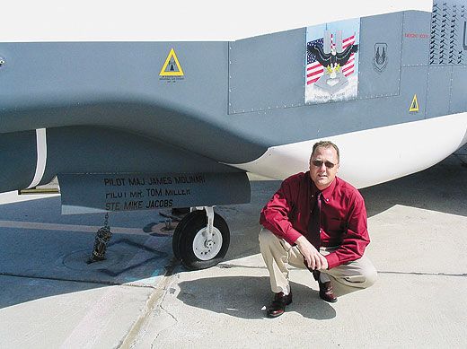
To train pilots on its three drones, NASA hired a pilot who had flown all of them. Tom Miller had logged some 1,500 hours flying Global Hawks, including with the flight test squadron at Edwards Air Force Base in California and later as part of Operation Enduring Freedom in Afghanistan. “It’s very cool to be asked to come back and fly them again,” he says.
Miller led training for the Pacific mission’s team and flew several of the missions himself. While some of the pilots had experience in manned high-fliers, like the U-2, none had previously flown a Global Hawk. Hall was the only one with a science flight background, having spent about 2,000 hours in NOAA’s Twin Otter.
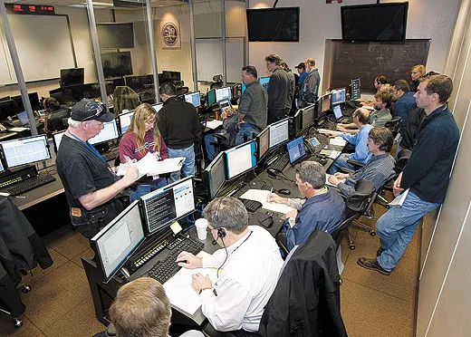
Global Hawk pilots fly by desktop—in this case, from a brand-new ground station at Dryden dubbed the Global Hawk Operations Center. The center is divided into three compartments: a chilly lobby where air conditioners cool the giant stacks of computer hardware that keep the airplane flying, and two glass-encased rooms, both facing an enormous screen displaying a live camera feed from the aircraft. The pilots work out of the front room; in the back room sit more than a dozen payload operators, keeping their eyes on computer monitors as their instruments stream real-time data to them.
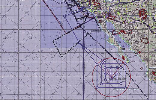
Global Hawk’s track is pre-planned; the aircraft flies on a scheduled airspeed and its bank angles are pre-set, although pilots can make mid-flight adjustments. “Typically—say, 75 percent of the time—we don’t stay on the canned mission plan because our mission objectives are usually things like weather and atmospheric phenomena, which move,” Hall says.
Pilots control the aircraft using four computer monitors, a keyboard, and a mouse. There’s no yoke—not even a joystick. Although they have a moving map that lets them track the aircraft’s progress over remote locations, there’s no feeling of motion. “You lose four of your five senses when you’re dealing with an unmanned vehicle,” says Miller. “You’re not in the airplane, so you don’t feel if the throttle comes back or you don’t feel it when it goes into a turn. Everything is based on sight, looking at the displays.” The pilots have no view out the aircraft’s window.
For the scientists, shifts can be long. Because some interesting bit of data could always come down the pipe, Newman says it was tempting to work long hours and late nights to get the data—“the scientific candy,” he calls it. He used to worry about ER-2 pilots flying over the Arctic: “If the engine flames out, if there is any problem with your ER-2, then you’re not getting that pilot or the plane back. There is no place to land up there, there are no runways, and it’s really brutally cold.” Now, he says, “I don’t have to worry about the pilots anymore—I have to worry about my own team and that they don’t drive off the road because they’re so tired.”
Because science and military missions have different objectives, NASA’s Global Hawk tried some new moves on its first two science flights. According to Chris Naftel, the Air Force had never taken a Global Hawk much past Fairbanks, Alaska, which is around 65 degrees north. Scientists want to get closer to the Arctic, a critical area for studying ozone depletion and other climate phenomena. On the Pacific flights, says Naftel, “we went up to 85 degrees—that’s about 300 miles short of the North Pole.” This is the farthest north a Global Hawk has ever flown.
Atmospheric scientists are equally interested in sampling near the equator, because that’s where greenhouse gases fountain up into the stratosphere before falling back toward the poles. For example, scientists would like to measure stratospheric water vapor—a greenhouse gas that is more insulating than carbon dioxide—to understand its effect on Earth’s surface climate.
But flying at high altitudes near the equator presents a risk: fuel freezing. “With our atmosphere, at 60,000 feet it’s actually colder at the equator than it is at the North Pole,” says Naftel. “The Air Force will fly around the equator for only about an hour, and now we have scientists that want to take eight or 10 hours of data there.” For such long-duration equatorial stays, NASA intends to take advantage of the Global Hawk’s heat exchange system, in which fuel is warmed through direct contact with the avionics equipment. The agency also hopes to utilize fuels that freeze at lower temperatures, says Naftel.
Ironically, one of the special requests scientists made during the Pacific mission was to have the high flier occasionally fly low. “We’re interested in other altitudes because some of the important things that we need to do are to take a cross-section of the atmosphere,” says Hall. “We’ll come down and loiter at a little lower altitude, maybe around 43,000 [feet] or so, and then go back up to altitude.”
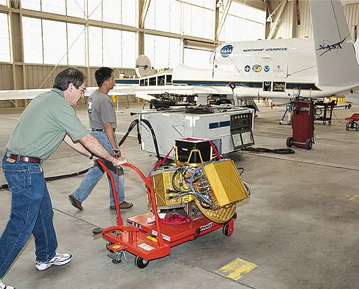
The aircraft itself was also modified for the Pacific mission. While the Air Force had typically flown two sensing instruments, says Naftel, “we had 11 instruments on GloPac, and they were all over the place: some in the nose, some under the bottom, but some were on the back of the airplane, some on the sides of the airplane.” Northrop Grumman designed a modular honeycomb pallet system for two of AV-6’s payload areas that allowed instruments to be easily added or taken out and returned to the scientists for data analysis or repairs. Among the instruments flying on the demonstration mission: a cloud physics LIDAR (Light Detection And Ranging) instrument on the nose to profile dust and aerosols, ozone and water vapor samplers, and chromatographs for measuring greenhouse and ozone-depleting gases like nitrous oxide, methane, and CFCs (chlorofluorocarbon compounds).
For the 2010 hurricane surveillance mission, the Global Hawk carried four instruments—including a radar for profiling wind and rain, and a microwave radiometer for measuring temperature and moisture—and faced new challenges. Because Global Hawk’s endurance allows it such a long outbound leg, it faces a lengthy voyage home, with diminishing fuel and uncertain weather. (Flights to observe Atlantic Ocean hurricanes took about eight hours out, with eight on station, leaving eight to return.) But because the unmanned vehicle can fly only over sparsely populated areas, it has fewer landing options in emergencies. “When you’re coming back and facing weather diverts, you’re always wondering, ‘Do I got enough to make it home, or am I going to have to go into one of these emergency fields?’ ” says Miller.
Hurricane surveillance also involves less-than-friendly skies: turbulence, lightning, and precipitation, all of which the crew was eager to avoid. “If you look at that airplane, with its long wing, it’s designed for a flight envelope that does not have high amounts of turbulence,” says Hall. “So we’re not permitted to fly in moderate or severe turbulence.”
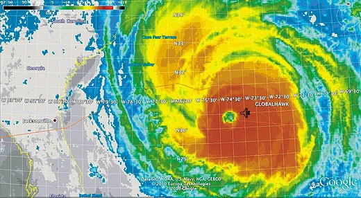
Hall, who was at the controls when the Global Hawk overflew its first full hurricane—Earl, off the South Carolina coast—says the experience was more dynamic than the GloPac demonstration mission: As the team assessed the storm’s severity, they called for more rapid changes. At first Hall avoided the hurricane’s eye, but after the team decided it was calm enough, he transected it, crossing the eye seven times on that mission; he flew near it another two. But Hall still had to keep alert for cloud tops that could provoke turbulence, as well as for lightning—a mission rule forbade coming within 20 miles of it. “It was a fun flight because it was busy and kept us challenged,” says Hall.
Global Hawk proved to be an excellent hurricane observer, says research meteorologist Gerry Heymsfield, one of three GRIP scientists. (On a later flight, over Hurricane Karl in the Gulf of Mexico, the Global Hawk made 20 passes, including 12 over the eye. By contrast, an ER-2 typically does about six passes.) He points out that duration is especially important in studying hurricanes, which can intensify rapidly within 12 to 24 hours. In the past, long-term storm coverage required multiple airplanes.
The hurricane observation mission, which also involved DC-8 and WB-57 aircraft, focused on gathering clues about how tropical storms originate, and why some blow into hurricanes while others fizzle out. The team investigated how temperature, wind, and moisture in the environment around storms affect their direction and intensification; the mechanisms that cause a cluster of clouds to start spinning; and the role of convection in intensifying storms. The mission also studied easterly waves, weather disturbances off the west African coast that trigger thunderstorms, which sometimes become hurricanes. “We’re trying to learn why some waves develop and some don’t, because they all look similar,” says Heymsfield.
NASA officials have a long list of what they’d like to do next with their Global Hawks. A portable ground station, which would allow a pilot to launch and land the aircraft in the East Coast while the payload operators remain at Dryden, is in the works for next year. Cutting out the cross-country transit would allow future missions to observe hurricanes that are farther away and for longer periods, which means earlier in their development. NASA is planning a Hurricane and Severe Storm Sentinel mission for 2012 that will fly two Global Hawks, one over the storm and another to study its environment.
A synthetic-aperture radar pod mounted beneath a wing is also planned, and thanks to an East Coast base, says Naftel, “I can see us going to Greenland from Wallops Island [a NASA rocket launch site in Virginia] to map the ice surface up there, to track the changes that are occurring, and doing the same thing over the North Pole and the South Pole.”
Perhaps most significantly, Northrop Grumman is developing technology for mid-air refueling between two autonomous vehicles, potentially allowing the receiving vehicle to stay aloft for up to seven days. A demonstration program is planned for next year.
With longer-endurance aircraft and perhaps a larger fleet on the horizon, NASA scientists envision autonomous aircraft like Global Hawk playing a routine role in monitoring the world’s weather and studying its atmospheric changes. Chris Naftel calls it “nearly a perfect science platform.” Attention satellite manufacturers: You may want to watch your backs.
Kara Platoni is a freelance science writer living in Oakland, California, and an instructor at the University of California at Berkeley’s Graduate School of Journalism. Her most recent story in Air & Space/Smithsonian was “The Six” (June/July 2009).