Swarms of small, orbiting cameras are coming. To watch.
Spysats for Everyone
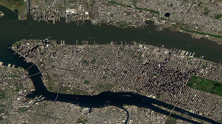
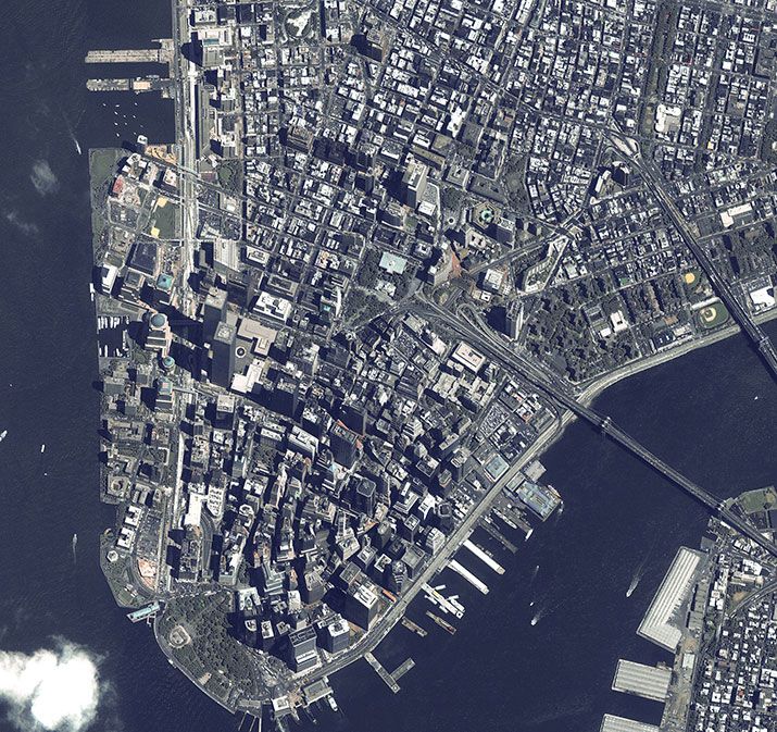
/https://tf-cmsv2-smithsonianmag-media.s3.amazonaws.com/filer/Spysats-Manhattan-631.jpg)
Four years ago, Wade Larson’s then-employer—Vancouver-based MacDonald, Dettwiler and Associates—sent him and a colleague to Moscow to brainstorm ideas for observing Earth from space. The Russian company Energia was looking for joint projects it could do from its segment of the International Space Station, and had invited MDA, a blue-chip aerospace company with lots of experience in remote sensing, to partner in something.
What came to Larson’s mind was a bird’s nest—specifically an eagle’s nest on Hornby Island, off Vancouver, where a live webcam, running 24/7, had attracted millions of Internet viewers. If the public would gaze at a screen for hours mesmerized by pictures of baby eagles, Larson figured, maybe they’d watch scenes of Earth beamed down live from orbit. All you had to do was attach a camera to the outside of the station and leave it running.
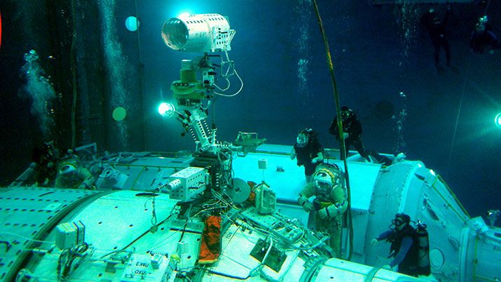
“The Russians loved it,” he says, and he took the idea back to his bosses in Canada. This November, two of Larson’s cameras will be attached to the Zvezda module on the ISS by spacewalking cosmonauts, as the private venture of a small Vancouver company called UrtheCast, co-founded by Larson to keep his unorthodox project alive after MDA decided not to pursue it.
If you like those time-lapse movies taken by orbiting astronauts, the ones showing auroras glowing and lightning storms flashing as the station glides serenely over the planet, you’ll love UrtheCast’s videos.
Two cameras will point straight down from the ISS altitude, about 250 miles, filming whatever is happening on Earth directly below them. One will take five-meter-resolution pictures (showing details 16 feet or larger), and the other will shoot higher-resolution (1.1-meter), high-definition video at three frames per second. Each video scene will show a patch of ground, about two by three miles, for about 90 seconds, says Larson. “We’ll collect 150 of those videos every day…. You’ll see true movement [on the ground].”
Because the station’s ground track shifts as it orbits 16 times a day, coverage of any particular location will be irregular, though frequent. For a mid-latitude city like Vancouver, the revisit rate is something like 900 times a year, according to Larson. Not every pass will produce usable pictures. Still, the UrtheCast images will be far sharper than the time-lapse views shot by astronauts. They’ll be almost (but not quite) a video version of the satellite view in Google Maps, with dot-like cars driving down the street, except that you’ll see your neighborhood the way it looked last Friday, not five years ago.
“From a space-borne platform, this is utterly unique,” says Larson.
UrtheCast is just one of the companies poised to take Earth imaging into a new era of frequent coverage, low cost, and wider public access. The new ventures are capitalizing on improvements in small satellite technology—long promised, but now becoming real—and the government’s easing of restrictions on the sale of images once produced only by spysats.
Just as important, the companies are applying modern, Google-era search tools to that imagery, making it easier to use and interpret for those of us who aren’t CIA analysts. Mapbox of Washington, D.C. is offering current map data and satellite images produced by others, with pricing plans starting at $5 a month for 10,000 “map views.” “Our goal is to have live imagery for publishing within six hours of an event, anywhere in the world,” says the company’s website.
What’s new here is not picture quality. UrtheCast’s one-meter-resolution pictures—good enough to make out cars in parking lots—will be far from the sharpest imagery on the commercial market. DigitalGlobe of Longmont, Colorado, sells pictures (to the U.S. government and Google, among others) that are twice as good. But only a few high-paying customers get to see the current stuff.
Now anyone will. Starting next year, you’ll be able to watch online, for free, HD videos from UrtheCast’s cameras almost as soon as they’re sent down from the ISS. The company will pin the videos to a base map that will fill in over time with all kinds of scenes, from momentous to trivial. “So you might see the president’s inauguration, the Springsteen concert, the Super Bowl,” says Larson. “Some things will have no social and redeeming value, just sort of silly things. Others will be more important—say, the riots in Egypt’s Tahrir Square or Hurricane Sandy. Our hope is that these videos go completely viral, that they create a unique kind of water-cooler event for people around the world.”
Having already raised $55 million, UrtheCast recently joined the Toronto Stock Exchange, and Larson expects his staff of 30 to grow to 80, with new offices in Russia and the United States. They already have an office in San Francisco, where the all-important Web interface is being designed.
Compared to past remote sensing ventures, the new ones have hardware costs that are absurdly low. UrtheCast’s first two cameras, built by the Rutherford Appleton Laboratory in England, cost $15 million. Digital Globe’s GeoEye-1 satellite, launched in 2008, cost nearly half a billion dollars to build and launch, and GeoEye-2, which was planned for launch this year but is now on hold, was even more expensive.
Larson doesn’t claim UrtheCast’s videos will compete with Digital Globe’s high-resolution pictures. Still, he says, “we will collect obscene amounts of data, obscene amounts. Our vision is to cherry-pick some of it for customers that want to buy it. And enormous amounts of it we’ll put up on our website for free.” He’s not sure exactly how people will use it, or what secondary applications might develop when they start playing with the raw data. “Candidly, we don’t know where this is going to go. We’re going to experiment."
Another player in the new market, Skybox Imaging of Mountain View, California, plans a constellation of 24 small Earth-imaging satellites, each weighing just 220 pounds, about 1/20 of what GeoEye-1 weighs. According to the company’s website, the satellites will “capture high-resolution imagery and the first-ever HD video of any spot on Earth, multiple times per day.” Skybox plans to start launching on a Russian Dnepr rocket by the end of the year.
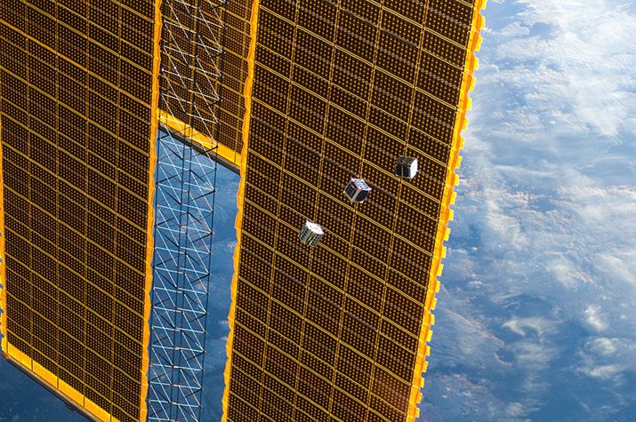
Maybe the most radical of the new wave of remote sensing ventures is Planet Labs, based in San Francisco. By the end of the year, the company intends to launch 28 of its Dove satellites, each the size of a toaster oven, into a low orbit similar to the space station’s, where they’ll be strung out, evenly spaced, like pearls. They’ll overlook most of the populated world below 52 degrees latitude (from London to the tip of South America), with frequent revisit times for any one location as Earth turns below (the company is still working out the details, and won’t disclose the exact frequency).
The 12-inch cubesats are packed with cheap but capable technology, like high-quality solar cells scavenged, literally, from scraps on the factory floor where larger, more expensive arrays are made, and X-band radio packages adapted from Wi-Fi components. The cameras use off-the-shelf optics, which, on such a tiny spacecraft, can manage only images with a resolution of three to five meters. That’s okay with Planet Labs. By limiting their first generation of satellites to medium resolution, they sidestep privacy concerns. “Users are able to see the canopy of a tree but cannot identify individual cars or persons,” the company is careful to point out on its website.
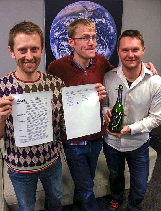
Steve Jurvetson of the Silicon Valley venture capital firm Draper Fisher Jurvetson, who has made Forbes magazine’s “Midas List” of tech investors three years in a row (a major backer of Elon Musk’s SpaceX and Tesla, he owns the first Tesla Model S to roll off the assembly line), joined other investors in a $13 million round of financing for Planet Labs. Jurvetson says his firm looked at many of the new Earth imaging startups and was attracted to Planet Labs for several reasons. One was the team. Two of the founders, Will Marshall and Chris Boshuizen, came from NASA’s Ames Research Center in Silicon Valley. There they worked on small satellite projects, culminating in the launch of three “PhoneSats”—tiny spacecraft built around barely modified Android phones, launched last April to test how far you could push the DIY, off-the-shelf approach to space hardware. Pretty far, it turns out. The PhoneSats—named Alexander, Graham, and Bell—worked fine, and even took decent pictures from orbit.
Marshall and Boshuizen, along with partner and fellow NASA alum Robbie Schingler, brought that same mindset to Planet Labs, which they formed (originally as Cosmogia, Inc.) in 2010. The first two prototype Doves were launched in April, within two days of each other, on two different rockets. Both performed flawlessly. Marshall says that when he showed the test pictures to photo-reconnaissance experts, including some with spysat experience, they were “absolutely astonished” at the quality produced by such a tiny satellite. “They saw it previously as almost a toy,” he says.
Jurvetson is also attracted to Planet Labs’ original approach to designing constellations of satellites. With cheap, assembly-line spacecraft and launch costs for the smallest ones around $300,000 and dropping, you can start to think in terms of what he calls “disposable satellites.” So what if the Dove “flock”—yes, that’s what it’s called—orbits so low that atmospheric drag will bring the satellites down sooner than typical Earth-viewing spacecraft (GeoEye-1 is nearly 200 miles higher)? Low orbit is a good thing. It gives you better resolution with a small camera. It solves the orbital debris worry—no need to actively deorbit the Doves so they don’t add to the space junk problem. And because the satellites have to be replaced regularly, the technology stays current.
What about the data collected by these shiny new things—who will buy it? Kevin O’Connell, who heads a Washington consulting firm called Innovative Analytics and Training and chairs the Department of Commerce’s Commercial Remote Sensing Advisory Committee, worries about the market. With a background in photo intelligence, he is as impressed as Marshall’s astonished spysat veterans by what these new smallsats can do in terms of image quality. But producing lots of new pictures won’t spell success unless there’s a solid business plan, he says. “If there’s one thing we’ve learned in the satellite business, it’s that ‘Build it and they will come’ will not happen.” Companies like UrtheCast and Skybox say they’ll pursue all possibilities for making money, from selling data to farmers monitoring the health of their crops to selling ads on websites where (they hope) millions will tune in to watch videos.
However the imagery market develops, O’Connell and many others watching this field agree that as lots of current, high-quality Earth images are produced, for free or very low cost, we could be on the verge of a revolution, as transformative to society as GPS and Google maps have been.
Marshall seems aware of the power this technology could unleash. A self-described “peacenik,” he wants his company to be a positive force for humanitarians and environmentalists, although he expects to make money too. Planet Labs’ website, with promises to “Do Good. Be Responsible. Provide Open Information,” echoes the Google philosophy.
Here’s one way Marshall sees the Dove images being used: Even if the cameras aren’t sharp enough to identify individuals, they will be able to notice when holes in the Amazonian forest suddenly open up. Today’s infrequent satellite coverage shows illegal logging only after the fact, when it’s too late to stop it. Marshall says: “What we want to do is provide data that enable people to act. ‘Oh, there’s some people today, at this latitude and longitude, doing logging in the Amazon. Let’s go and stop them.’ ”
In November, the UrtheCast cameras will go up to the space station on a Progress-M cargo vehicle, and spacewalking cosmonauts will attach them to the outside of the Zvezda module. Skybox and Planet Labs hope to start launching their satellite consttellations around the same time.
By early next year, all of them will be clicking away from orbit, sending down terabytes of image data to dishes on the ground, all day every day, for anyone to view. Expect more Earth-viewing smallsats in the future, ever more capable and growing in number.
If you’ve got something to hide, you’d better bring it inside.
Tony Reichhardt is a senior editor at Air & Space.