Hey, What’s That Satellite Overhead?
These handy websites and smartphone apps eliminate the guesswork
/https://tf-cmsv2-smithsonianmag-media.s3.amazonaws.com/filer/90/99/9099fc73-d6c1-4dd3-97c3-994cea481350/percival_lowell_observing_venus_from_the_lowell_observatory_in_1914.jpg)
![]() We used to have to know things. Now we have smartphones.
We used to have to know things. Now we have smartphones.
Let’s say I’m standing in my backyard on a clear night, and I notice a bright planet about to set in the west, just over the fence. Jupiter or Saturn? With the naked eye it’s hard to tell, at least for me. But point the Google Sky phone app at the mystery dot, and I know in seconds. Jupiter. Thanks.
We should be astonished at such fact-finding power, but we rarely are. Maybe that’s because web- and phone-based tools for identifying what’s in the sky overhead are becoming more common at the same time as they’re getting easier to use. And most of them are free. NASA just released a nifty Interactive Satellite Viewer, for example, that shows you the current positions of its Earth- and space-pointing spacecraft. It’s similar to other online satellite trackers that have been around for a while, but it’s nicely done.
Even cooler are the smartphone apps that use augmented reality to display the positions of satellites wherever and whenever you happen to be looking. These include Sat Tracker for Layar and — even easier — the Satellite AR app created by Analytical Graphics, Inc. (AGI), who maintain a constantly updated database of all the orbiting objects tracked by U.S. Strategic Command. Look up for more than 15 minutes from any dark location at night, and you’ll likely spot the slow, steady track of some satellite crossing the sky overhead. With Satellite AR, you don’t have to guess which satellite it is. A cartoon-like icon will be superimposed on the real thing.
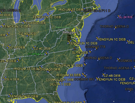
Best of all is the Google Earth version of AGI’s satellite database. Now you see not just the operating satellites, but all the bits of flotsam orbiting with them. Here’s a screen grab from my location in Virginia. Man, is there a lot of junk up there, most of it debris (DEB) from past launches and explosions. Thanks to these handy tools, I can track all of it, and watch the trash float by in real time.
Update: See the first comment below for yet another version that’s even better.
