Air Traffic Control Enters the 21st Century
NextGen looks to overhaul navigation and communication in U.S. airspace.
/https://tf-cmsv2-smithsonianmag-media.s3.amazonaws.com/filer/5d/91/5d9133d1-0b22-43c8-8f51-84ac24c86397/03k_fm2018_replace03j_live.jpg)
It’s a frigid March morning at John F. Kennedy International Airport in New York as jet after jet roars overhead, noses up, clawing its way into the air. The only clue that a late-season snowstorm canceled more than 700 flights at this airport just two days earlier is the dirty slush still lining the streets of New York and the meltwater dripping from the bridges.
At most airports, the morning’s air traffic volume would be considered exceptionally heavy, but in the top of JFK’s 18-story air traffic control tower, it’s business as usual, the four controllers speaking softly to one another and into their headsets. It’s not always like this, says Steve Abraham, a seasoned air traffic controller and local chapter president of the National Air Traffic Controllers Association. “When things don’t work well, there is definitely a different level of volume,” he says with a laugh. When there are pop-up thunderstorms or traffic jams on the taxiway, “there is cacophony back and forth across the tower.”
I was at JFK that frosty day for a demonstration of a new technology designed to keep things working well and voices low in the control tower. Called Data Communications, or Data Comm, it represents a simple idea: Instead of transmitting complex clearance information between controllers and pilots over a crowded radio channel, why not send it directly to the airplane’s flight computers? This could speed up the clearance process when the controllers are dealing with problems. Says Abraham: “Our ground controller—during a big thunderstorm even, there is no person busier in the FAA.”
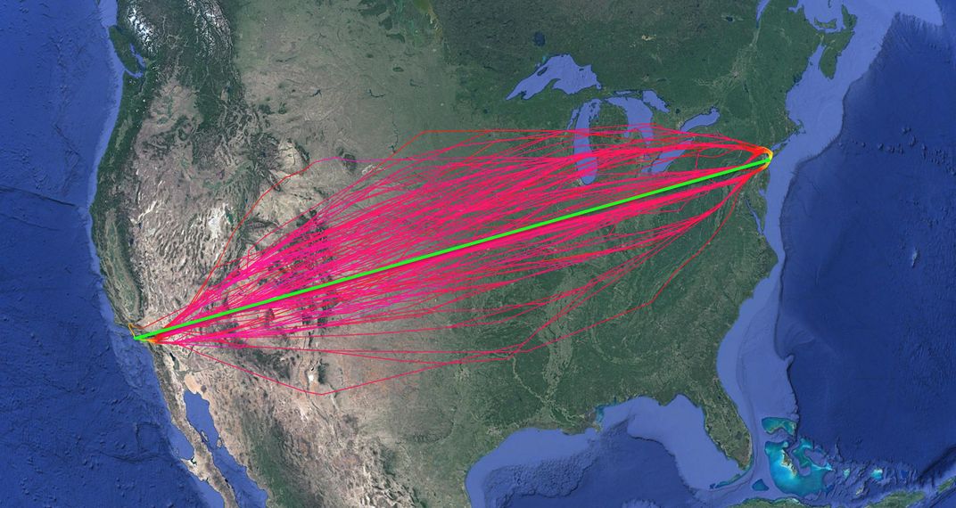
Data Comm is just one component in a vast and ambitious program, called NextGen (short for Next Generation Air Transportation), in which the Federal Aviation Administration is overhauling the way aircraft navigate and the way controllers track and communicate with them. Satellite navigation can allow aircraft to fly smooth, efficient point-to-point routes rather than zigzagging between ground-based navigation beacons and stair-stepping to change altitudes. Satellite-based surveillance, meanwhile, can give air traffic controllers—and other pilots—more accurate and timely location information than radar can, allowing aircraft to fly closer together. But no matter how you arrange airplanes in the sky, there’s a bottleneck at the end points, which is where Data Comm comes in, making the best use of what Abraham says is the scarcest resource in the airspace: “It’s the runway. You can have 100 routes into New York, but everybody has to line up eventually and land.”
JFK handles some 800 departures a day, and when foul weather creeps in—to New York or to any other major airport, because airplanes leaving JFK are headed to destinations all over the world—dozens of aircraft on the taxiway can require last-minute changes to their flight plans. The tower controllers must then issue a new departure clearance to each of them, which can be a lengthy process as they spell out each navigation waypoint and route to ensure there’s no confusion: “JetBlue 353 cleared for Palm Beach airport, SKORR3 departure, Yankee transition, expect radar vectors to WAVEY, Whiskey, Alpha, Victor, Echo, Yankee. Direct EMJAY, Echo, Mike, Juliet, Alpha, Yankee; J174 Snowhill SWL, Sierra, Whiskey, Lima; direct CEBEE, Charlie, Echo, Bravo, Echo, Echo…” and so on, in the example Abraham gives me. The flight crew must copy these down exactly, then repeat them back to the tower to ensure accuracy. They then run the clearance by their airline’s operations center to make sure they have enough fuel to fly the new route. Finally, they must then break through the crowded radio frequency to accept the clearance, a task made tougher for the many foreign operators for whom English is a second or third language. All this can take 10 to 12 minutes, Abraham says, and all while the flight crew is taxiing and preparing the airplane for flight. It’s a recipe for errors and cascading delays. “When that airplane is not moving, it’s a roadblock, it’s a Jersey barrier,” says Abraham.
Data Comm, on the other hand, allows the controller to send a clearance directly to the cockpit, and to the airline’s dispatcher, with the push of a few buttons, taking a little more than 90 seconds. Later, in the cockpit of a brand-new JetBlue Airbus A321, I see how it simplifies things for the flight crew as well: A single button signals the tower they WILCO—will comply. Another inserts the new routing information into the flight guidance management system. It’s as easy as receiving a text on a cellphone. The obvious question is: Why weren’t we doing this already?
Diagnosing the problem was easy; it’s modernizing outdated air traffic control equipment that’s hard. “Some of it is technology that evolved from the early 1950s, 1960s,” says Pam Whitley, FAA acting assistant administrator for NextGen. Radar and radio are well understood, robust, and safe, but they have limitations. “In order for us to be more efficient, to get more out of the system, we had to modernize that infrastructure,” Whitley says. The modernization is a transition from an analog environment to a digital one. That’s a long and heavy lift, given the complexity of the communication and tracking systems and the FAA’s bias toward safety over innovation. Apple can release a new phone, solicit feedback, and patch issues within three weeks, but “I don’t have that luxury when I am moving people,” Whitley says.
In the summer of 2000, for the second year in a row, flight volume overwhelmed the nation’s air traffic management system and caused a wave of delays and cancellations. Congress instructed the FAA to modernize air traffic control, and in 2007, the agency released its “Concept of Operations for the Next Generation Air Transportation System.” According to Whitley, you can think of air traffic management as four overlapping areas: communications, navigation, surveillance, and automation. In order for NextGen to work, all four have to be modernized.
The first navigation system, set up in the 1920s, was a series of cement arrows on the ground, spaced about 10 miles apart, which airmail pilots could look down at to follow major routes; the arrows were supplemented by rotating light beacons for night flights. Improving airplane performance quickly made visual-only aids obsolete, and by the 1950s, the United States had a comprehensive system of radio transmitters called non-directional beacons (NDB) and VHF omnidirectional range (VOR) beacons. These transmitters had a roughly 120-mile range and were placed so that an airplane at any point in the United States could receive clear signals from at least two of them. Both the sites of the beacons themselves and the strategic places where their beams intersected became the navigational waypoints still in use today. A saw-tooth track between radio landmarks might not take airplanes far from the ideal flight path, but the airline industry measures fuel by the ton and time by the minute: Every inflight inefficiency chips away at a slim profit margin, and even slight diversions from the ideal stack up quickly.
The Global Positioning System has made it possible to chart fuel-efficient paths from origin directly to destination. Its precision also enables smooth descents, rather than the traditional speed up/slow down, altitude stair-stepping approach. Called performance-based navigation (PBN), the new procedures became available for airliners flying in certain locations even before formal NextGen implementation began broadly in 2010. The FAA has focused on metroplexes—major cities with multiple commercial airports—where PBN approaches save the most time and fuel. Houston got a metroplex upgrade in 2014, and the Washington, D.C. area in 2015.
Data Comm came later, but it is one of NextGen’s greatest successes so far. By late 2016, the FAA had equipped 55 major airports with the technology, almost two years early and under budget. By 2019, the agency hopes to extend Data Comm beyond aircraft departing from the terminal to those that are already en route at cruising altitude.
But telling airplanes where to go requires knowing where they are. Aircraft tracking has for decades depended on ground-based radars, which take 10 to 12 seconds to complete a sweep of the airspace. That time was built into the time and distance—the separation—that the FAA mandated between airplanes taking off from and arriving at airports. “We used longer separation standards, so we kept the aircraft farther apart because we knew we had a time delay,” says Whitley. Today, by requiring each aircraft to constantly broadcast its GPS-verified position, a new technology, Automatic Dependent Surveillance–Broadcast (ADS–B), gives controllers a precise fix on each airplane in the airspace. In addition to the controller, other pilots get the same information—everything needed to avoid a midair collision without having to rely on the controller on the ground. All aircraft flying in U.S. airspace will be required to carry an ADS–B transponder by 2020, the same deadline as that set by the European Union for aircraft under its authority.
And yet better aircraft position information, like any data, is useful only if it can be turned into helpful knowledge. That’s where automation comes into play.
“This is Dallas/Fort Worth,” says Brian Lawrence, senior management of advanced technologies with Veracity Engineering. “This is live data going on right now.” A display screen shows an overhead schematic of DFW airport. Green arrows tagged with flight numbers round a taxiway at the north end, and white arrows stream in from the north. These are American Airlines flights departing from and arriving at the airline’s Dallas mega-hub, as shown by Veracity’s AIRPORTinsight software, which the company built especially for American. Viewers can toggle between windows showing the departure queues, the queue for deicing, the last known position of an aircraft—all the information American’s operations department needs to coordinate offloading and reloading of aircraft. “Before AIRPORTinsight,” Lawrence says, “the [American employees] in the ramp towers, the ones that are actually moving planes, placing them at gates, pushing them back, dealing with all the bags—they had no visibility except out the window.” Now all this data is available to all the players in real time, wherever they happen to be in American’s system. Lawrence is giving me the DFW tour from Veracity’s D.C. offices.
Initially, Veracity obtained aircraft location data directly from airport radar, but would go elsewhere for, say, weather data. The FAA now integrates all relevant aviation data into one stream. Says Whitley: “What we had to do was take all of our old systems that didn’t talk to each other, modernize those systems, and get them in a digital format.” Now any new program or application can pull data from that stream, be it new radar and ADS–B displays for tower controllers, or AIRPORTinsight.
Integrating that data cleanly isn’t just more efficient, it also makes flying safer, says Michael Hawthorne, Veracity’s vice president for strategy and development. A safety failure is, after all, the ultimate inefficiency. And with a system as big as the U.S. national airspace, which has so many moving parts and such a small margin for error, everyone has to carefully assess how any new developments will, or will not, function together.
**********
From the outside, the MITRE Corporation campus in McLean blends in with all the other nondescript northern Virginia office complexes. On the fourth floor of Building Two, however, the Integrated Demonstration and Experimentation for Aeronautics, or IDEA, Lab, is every bit the Hollywood depiction of an aerospace research center. At the lab’s entrance is a multi-panel video display of the U.S. airspace on a single day in April 2014. “It’s an interesting day because there is a weather system that blocks the whole center of the U.S., which causes issues with routing aircraft around the weather,” says Matthew Pollack, associate department head for air traffic management. The dynamic visual provides the viewer with an instant understanding of the complexities involved in overhauling air traffic control. At the peak of the day’s traffic, the display shows the sky full of airplanes—around 6,000—but, Pollack says, “these are just those with active instrument flight plans.” That depiction excludes most general aviation traffic.
The national airspace cannot be turned off to test whether new technologies or procedures will work with both legacy equipment and legacy humans, but complex simulations in the IDEA Lab provide a pretty good substitute. Using rows of reconfigurable air traffic controller radar displays and extremely realistic tower and flight simulators, the lab runs “human in the loop” simulations, in which real pilots and controllers can gauge how the existing systems and procedures of the national airspace will react to new technologies and procedures, says Rob Strain, senior principal systems engineer. “Each of these has to be run through its course and vetted.”
On the day of my visit, the lab was working on a demonstration of a new system of arranging aircraft on approach to a runway, with a separation of, say, 120 seconds. Figuring out how to do this in the crowded airspace near the terminal is essential to achieving the ultimate NextGen goal: scheduling based on end-to-end time across all phases of flight. It may seem like a small change, but by directly instructing the airplane precisely what time to be where, a time-based approach could let controllers schedule a whole night’s arrival stream well in advance, instead of the current system, in which controllers vector arriving airplanes into the approach pattern on a first-come, first-served basis. “It’s a bit of a paradigm shift,” Strain says. “Instead of managing individual flights, you are now managing a schedule.” Andrew Mendolia, lead human-centered engineer, tests time-based separation by piloting the IDEA Lab’s Boeing 777 cockpit simulator through a virtual approach into Phoenix. He adjusts the airspeed to maintain 120 seconds behind a phantom lead aircraft, with the autopilot handling the rest. When Data Comm is finally integrated into real aircraft, these adjustments could potentially be sent via its channel and implemented by the auto-throttle system. Assuming, of course, MITRE’s research shows that it is useful and can be integrated with the rest of NextGen. A sideboard display in the simulator provides advanced air traffic data made available through ADS–B, a mockup of a potential future version of the Traffic Collision Avoidance System, or TCAS, available on commercial flight decks today. The simulator is designed to assess whether this would give pilots more situational awareness or crowd their instruments with unnecessary data. To paraphrase Pollack, they really test the heck out of these things.
But in the world of general aviation, things are different. Pilots are often less experienced and are flying in sometimes‑uncontrolled airspace, so safety often comes down to keeping your head on a swivel. Unfortunately, Strain says, the human eye is just not very good at spotting small aircraft or other aircraft beyond a few tenths of a mile away. “That’s just awfully close,” he says. Displays of air traffic using ADS–B data, or “ADS–B In,” may be futuristic for commercial flight decks, but for many light aircraft pilots, the future is already here.
Kyle Chevis is a corporate pilot for Skytech, Inc., a Piper Aircraft dealer based at the Carroll County Regional Airport, a small, rural Maryland airport near the Pennsylvania border. Carroll County has no tower, so in the uncontrolled airspace, it’s the practice of pilots (though not a regulatory requirement) to make regular position reports over the radio for the benefit of other aircraft.
One such day, Chevis was joining the landing pattern in a Piper M350, making his usual position reports. “The next thing I know, there is a Piper Cub right in front of me, pointing directly at me.” The Cub was not equipped with TCAS and its pilot was not making radio calls, so Chevis had no way of knowing it was there. He banked—sharply—and avoided the Cub, but the experience convinced him of the value of universal ADS–B transponders. “That’s the one thing that I am personally looking forward to,” he says. “It will lead more light general aviation targets to have reliable traffic position reporting data that I’ll be able to get.”
In another M350, Chevis shows me around the G1000 glass cockpit, the upper end of avionics available to most general aviation pilots. There are two synthetic-vision displays, showing the horizon and the runway, as well as the center screen, which can call up weather and sectional charts. This is also where the TCAS system displays other aircraft, based on either their radio transponders or ADS–B signals, and it’s easy to see which is which: Most aircraft show up as a dot with an altitude, but aircraft that are broadcasting ADS–B present as an arrow-like vector, their tail numbers available with the click of a cursor.
Of course, not every recreational pilot has the resources or the inclination to upgrade an older aircraft with ADS–B In. This is especially true since ADS–B In is optional, whereas by 2020 all aircraft must have an ADS–B Out transponder. According to the Aircraft Owners and Pilots Association, that can cost between $5,000 and $6,000. The upside is that once more general aviation aircraft upgrade with the mandatory ADS–B Out, the cost of getting ADS–B In data will not be as steep as it once was. “I would believe the majority of general aviation pilots are using iPads nowadays,” Chevis says, pulling out his own tablet. Unlike a commercial flight deck, where avionics must be specially certified, a small aircraft pilot can tether a tablet to an inexpensive ADS–B receiver and use an app—Chevis uses ForeFlight—that can display traffic, weather, and charts. With an iPad strapped to the yoke, small-aircraft pilots can have the flying equivalent of Google Maps directions in their cockpit, something not yet approved for commercial flights. Chevis notes that when Skytech pilots operate charter flights, which come with strict equipment requirements, they have to put the uncertified iPads away and pull out their paper charts.
The future of air traffic control may hold more exotic technologies, including remote control towers, which allow controllers to monitor multiple airports from a single location, and even augmented-reality displays that would let pilots and controllers see through bad weather. But you won’t have to wait until 2025 to experience the benefits of NextGen. You likely already have, if you’ve flown commercially in the past few years, even if you didn’t notice: Airplanes push back from the boarding gate sooner, and descent may be a smooth, even glide instead of the once-typical stair-stepping. The changes taking place are incremental, smoothing one wrinkle from the fabric of the national airspace at a time, and we passengers tend not to notice the small things that go right when we fly—it’s delays and lost luggage and other irritations that stick in our memories. Air traffic management succeeds most when it goes unnoticed.

Subscribe to Air & Space Magazine Now
This story is a selection from the February/March issue of Air & Space magazine