Cities at Night: An Astronaut’s View
Urban nightscapes are among the most beautiful sights in orbit
/https://tf-cmsv2-smithsonianmag-media.s3.amazonaws.com/filer/night-cities-flash.jpg)
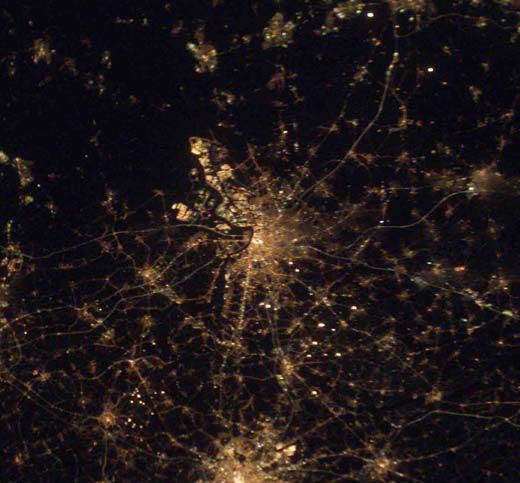
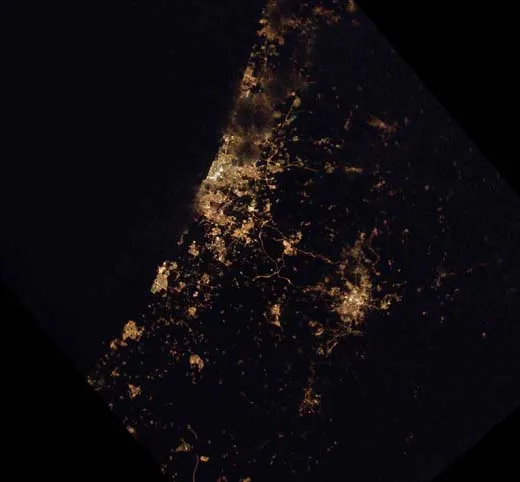
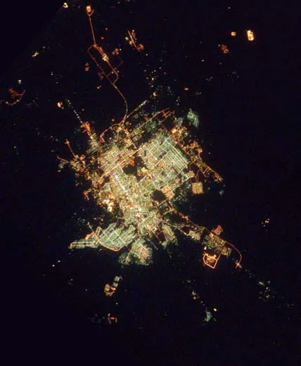
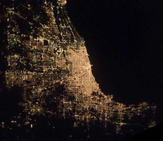
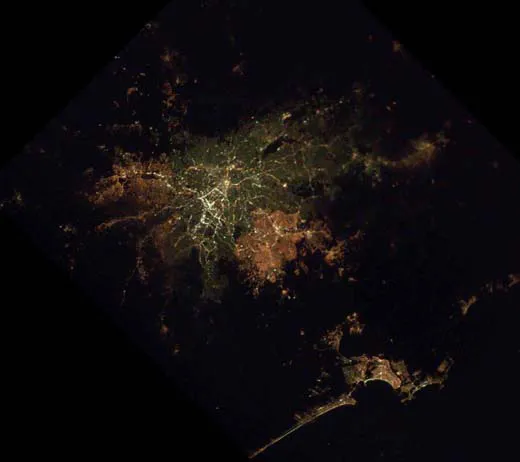
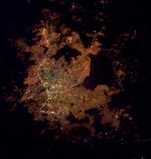
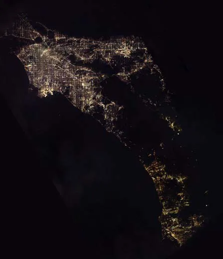
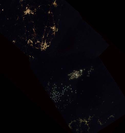
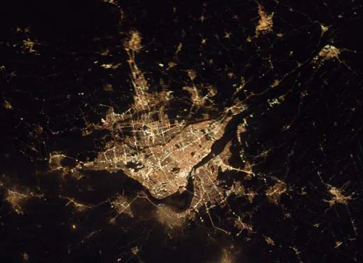
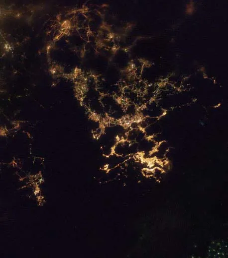
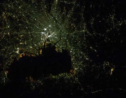
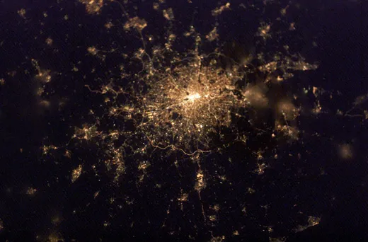
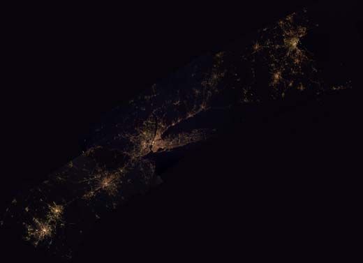
The richness of how humans sprinkle their lights across the nightscape is striking when viewed from orbit. These lights present a spectacular display, like tendrils outlined with the glimmer of a Broadway marquee. They also display a recognizable form of pollution by light. Colored patterns caught in a triangle between technology, geography, and culture radiate into space something about who we are.
If the lights are mercury vapor, cities appear blue-green. Sodium vapor yields yellow-orange. Some cities are mostly dark, yet adorned with bright main arteries. In others, whole urban areas resemble the "yellow zone" on a standard atlas. Some cities have major streets in north-south, east-west grids; in others, streets radiate outward like a spider web. The countryside in some areas displays a fractal pattern that resembles a snapshot from Mandelbrot space.
Political boundaries emerge as well, but distinct from those seen by day, and most surprisingly from the vantage point of orbit.
In the ocean, as if forming a constellation of stars, fishing boats with intense xenon lights create unfamiliar members of the Zodiac.
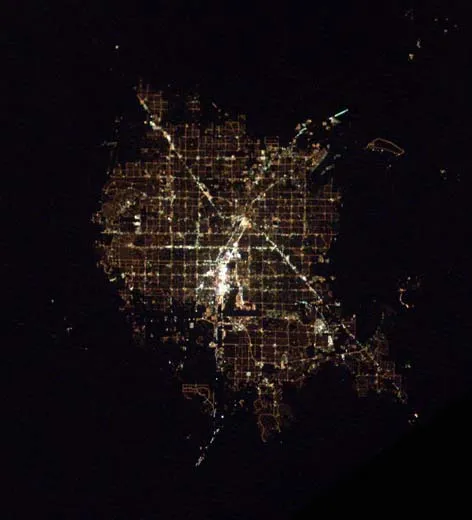
Like the spectacular sunsets caused by air pollution, cities at night (a form of light pollution) may be among the most beautiful unintentional consequences of any human act. Las Vegas, as if a beacon for humanity, appears as truly the brightest spot on Earth.
Cities around the world each project something different into the night. Could their designers and builders have anticipated this? It’s doubtful.
The Method
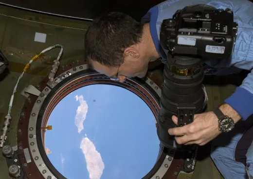
The unaided eye sees incredible detail when gazing upon cities during a 40-minute pass around the dark side of the planet. Efforts to record this beauty on film are only a natural extension of human desire. But capturing clear images of cities at night has eluded the best efforts of astronauts for years. Detail becomes a fleeting phenomenon due to orbital motion, which scoots by at an amazing speed of 4.4 miles per second. The very act of getting a daytime picture is hard enough. During an exposure of 1/1000th of a second, 23 feet of Earth move past, and the resulting image gets blurred. Appreciating the effects of this motion is something that every rookie learns after arriving on orbit. When using the monstrous 800mm telephoto lens, it takes a month or more of practice until new crewmembers can achieve its ground resolution of 10 feet.
Clear images of cities at night require such slow shutter speeds that, if taken on Earth, they’d require a tripod. To compensate, you float over the window and slowly pan the camera while looking through the viewfinder. This manually cancels out orbital motion, while, to the best of your ability, you hold the camera still in all other axes. Then you depress the shutter button and make the exposure. The slightest jitter results in a blurry image.
Such photos tend to disappoint because of how poorly they compare to the real spectacle. It was no different for me and my crewmates, commander Ken Bowersox and flight engineer Nikolai Budarin, of Expedition 6, aboard the International Space Station from November 2002 to May 2003. Our best efforts at obtaining images of cities at night fell far below what we saw through the window. After numerous failures to capture this beauty, you tend to revert to taking it in with your eyes, simply enjoying the temporary satisfaction of being there.
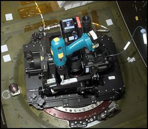
Determined to do something about it, however, we designed a tracking system from spare parts on the space station. These allowed for manual but precise tracking of cities at night, and canceled out the effects of orbital motion while holding all other axes steady during the exposure. We found the movie camera mount that had been used to film parts of the Imax feature "Space Station." It had been dismantled and stored in a closet, so we figured nobody would mind if we used it. That mount became the framework for our tracking system. We attached it to the US LAB window, and aligned one axis of a gimbal with the direction of orbital motion. By steadily panning the mount, we could cancel that motion. To precisely move the axis, we attached a long threaded bolt driven by a variable speed drill driver, which pushed on the platform and gave us a smooth motion. With a gradual squeeze of the trigger, our variable speed drill driver rotated the bolt in a smooth and precise way.
We mounted two cameras on the platform. One had a telephoto lens that simply acted as a spotting telescope. We looked through this lens and squeezed the drill driver trigger until the image of cities stood stationary, which told us our orbital motion had been precisely cancelled. With the second camera, we took the picture with a cable release.
Amateur astronomers will recognize that what we cobbled out of spare parts on the space station is no more than what they have been doing for decades with a simple tracking system dubbed a "barn door." This consists of two boards, a piano hinge, and a manually rotated bolt. This simple platform lets you counter Earth’s rotation while taking images of space. Our "barn door" allowed the reverse: from space we countered our orbital motion while taking images of Earth.
This tracking system allowed for much greater precision. The resulting images proved spectacular. While still short of what the eye sees, they are a significant improvement. The system gave us a resolution of ground objects in the 200-foot range.
Once we had refined the technique of operating our barn door tracker, we systematically took images all over Earth. Not only did we record the bright and striking urban areas, but remote, dark regions as well. As long as sufficient light allowed us to focus and track, we took photos. During Expedition 6, we recorded over 2,500 images. Counting subsequent missions, there is now a database of over 5,000 images that are in the process of being assembled at NASA’s Ames Research Center into a nighttime “Google Earth” model. Collectively, this data set will have scientific value as a snapshot of humanity's nocturnal footprint, including a record of light pollution.
The International Space Station is an orbital laboratory. As with most labs, it was designed with specific research purposes in mind. And, as so often happens in earthly laboratories, the real value of discoveries falls outside the realm of the preconceived intent.
NASA astronaut Don Pettit is scheduled to fly aboard space shuttle Endeavor in early November on mission STS-126, a resupply visit to the space station. See his article in the October/November 2008 issue of Air & Space about his harrowing return to Earth in a Soyuz vehicle.