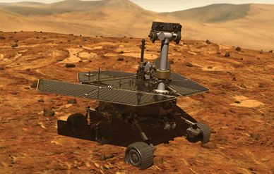
Next Stop Gusev Crater
If planetary scientists could do whatever they wished, they’d probably send a spacecraft to land on the floor of Valles Marineris.
/https://tf-cmsv2-smithsonianmag-media.s3.amazonaws.com/filer/crater-388-jan04.jpg)
IF PLANETARY SCIENTISTS COULD DO WHATEVER THEY WISHED, they’d probably send a spacecraft to land on the floor of Valles Marineris, a gaping canyon that stretches 2,500 miles across the Martian surface, exposing the planet’s past in pancake-like layers of rock. But the twin NASA spacecraft due to land on Mars in January won’t be going there.
Researchers might be just as happy to have robots roam Gale Crater, a saucer-like depression near the equator of Mars that may once have held a body of water shaped like Oregon’s Crater Lake. But the landers, with wheeled rovers larger and more capable than Mars Pathfinder’s Sojourner robot, which roamed the planet in 1997, won’t be going to Gale either.
Hundreds of scientists and engineers spent close to three years sifting through more than 150 destinations for the Mars Exploration Rovers (MER) before they settled, with a sigh of relief, on two: another lake-like crater called Gusev, named for 19th century Russian astronomer Matwei Gusev, and a mineral-rich plain called Meridiani Planum. Never before had scientists looking for places to land on the Red Planet had so many options. Never had they known so much about each candidate site ahead of time. And never had the stakes for getting there seemed quite so high.
Unlike Pathfinder, the $800 million MER is not a demonstration of new technology. This time the spacecraft’s job is to return information, particularly clues about whether life once existed on Mars. Researchers scrutinizing the planet’s surface for landing zones had to weigh the scientific interest of the site against the odds that winds, rocks, or some other hazard would knock the craft out of commission. Two-thirds of all past attempts to reach Mars—including NASA’s 1992 Mars Observer, the 1998 Mars Climate Orbiter, and the 1999 Mars Polar Lander—have crashed or otherwise failed, and MER project managers are only too aware that another spacecraft loss could jeopardize NASA’s plans for Mars exploration.
“You always have to take some risk, but you want to be sure you take it in a calculated manner,” says geologist Matt Golombek of NASA’s Jet Propulsion Laboratory in Pasadena, California, who co-chaired the committee that selected the landing sites. “It doesn’t matter how important the science payoff is—if you don’t land safely, you don’t get anything.”
So in September 2000 the committee began laying the groundwork for an exhaustive series of reviews to choose destinations for the rovers, which will explore out to a radius of about three-quarters of a mile from their landing sites. “Everyone just wanted to tear into everything, pick everything apart,” says Golombek. Even though many researchers who joined the discussion originally championed other sites, almost everyone agreed in the end that Gusev and Meridiani are, on balance, the two best places to land. That doesn’t mean they are the most interesting scientifically, or that they pose the lowest risk to MER’s cocoon-like airbags, which will bounce as many as a dozen times to cushion the shock of landing. But in the calculus of risk and reward, they emerged the winners.
Scientists did not have the whole of Mars to choose from. The need for solar power to keep the rover instruments running during the 90-day science mission limited the options to a narrow band around the planet’s equator, covering just 10 percent of the surface. Farther north or south, the sun would be too dim, and the instruments could be crippled by night temperatures dipping below –200 degrees Fahrenheit.
High elevations were out. Otherwise the descent through the wispy carbon dioxide atmosphere would be too brief to allow the parachute to pop out, the airbags to inflate, and the retro-rockets to fire before the craft hit the ground. The terrain also had to be fairly flat. Slopes steeper than two degrees over about half a mile, or more than 15 degrees over about 30 feet, could send the airbag-enveloped landers rolling out of control.
Despite these constraints, MER had a huge advantage over past Mars landers. Two spacecraft currently in Martian orbit—the 1996 Mars Global Surveyor and 2001 Mars Odyssey—had photographed potential landing zones in unprecedented detail. Mission designers had millions of close-up snapshots to work with, compared to fewer than 8,000 less-detailed pictures taken by NASA’s Mariner orbiters prior to Viking, the first successful Mars landings in 1976. Looking back on that mission, Tim Parker, a JPL planetary geologist who took a leading role in the MER site selection, says, “There was so much we didn’t know, there were probably some definite luck factors” in Viking’s success.
Even with Pathfinder, “the ignorance we had was probably rather blissful,” Parker says. Since then, closer looks at the planet have revealed that the landing zone has potentially dangerous gullies and hillocks that mission planners didn’t know about at the time.
While having more information made picking the MER landing sites easier, it didn’t always seem that way to the scientists. The two spacecraft, named Spirit and Opportunity, are the most advanced robots ever sent to Mars. Not only are their instruments better—the cameras sharper, the spectrometers for determining rock chemistry and mineralogy more discriminating—but their aiming will be more precise thanks to upgraded navigation software and other improvements since 1997. Pathfinder needed a landing zone so big—about 60 by 150 miles—that there were only a few places flat and smooth enough to touch down. But the MER landers can home in on a target area about a quarter that size.
When Parker sat down at his high-powered computer to study digital maps of the surface, he kept finding more places where he could fit a stretched-out ellipse outlining the minimum runway MER needs to land.
He managed to identify about 155 candidate ellipses in all sorts of terrain. A couple of the potential sites—Melas Chasma and Eos Chasma—were within Valles Marineris, the largest canyon in the solar system. Another fell near Apollinaris Patera, a volcano that shows signs of having once sent water gushing to the surface. Still another covered what looks like a vast system of river channels called Athabasca Vallis, just downstream from where a major flood appears to have raged.
With 155 possibilities, it became much tougher to decide where to land, especially when scientists could study each one in more detail than ever before. Public meetings started two years before launch so that scientists could argue for their favorite sites; this added another layer of outside review and countered the criticism that NASA liked to make closed decisions.
“Not only did we have more data than any other landing site selection process, but we also had more people, more eyes, more minds thinking about this than ever before,” says John Grant, a geologist at the Smithsonian’s National Air and Space Museum who co-chaired the landing site committee. “It meant there were no surprises.”
It also was no surprise that some of the favorites reflected individuals’ own research interests. Some scientists pushed for sites that would help them understand the magnetic orientation of Mars. Others wanted to know about ice near the poles. Most, though, agreed that the search for life should drive the mission. They ranked the top sites based on whether they might turn up evidence of water—a basic ingredient of life—and whether any signs of past biological activity might remain.
Superimposed on this scientific priority list were other concerns, mostly having to do with safety—how many hazardous rocks littered the landing zone, what was the likelihood of dust clouding the rover’s cameras or blanketing the solar arrays. Even the local scenery was considered—disguised, in unemotional science-speak, as “public engagement” and “site aesthetics” that would appeal to taxpayers. Once these factors were added, the 155 candidates dwindled to fewer than 10.
On occasion, amiable tug-of-wars broke out, with engineers preferring to avoid risk and scientists pulling for a site full of intriguing mesas and ravines. “Sometimes you could tell from [the engineers’] body language,” recalls project scientist Joy Crisp. “It said ‘No, I don’t want to go there.’ That made the rest of us nervous.”
More often, though, “it was the scientists saying ‘We want to go there’ and the engineers saying ‘Let’s see if we can,’ ” recalls JPL’s Mark Adler, the mission’s lead engineer. Meridiani Planum, for example, captivated scientists because it holds a big outcropping of hematite, a mineral that typically forms in the presence of water. But its elevation was a bit too high. Engineers solved that by upgrading the MER navigation system so the spacecraft could better measure the distance to the ground, and adding rockets to compensate for unpredictable winds. That provided a large enough safety margin to make Meridiani a go.
To better simulate landing conditions at the top candidate sites, mission planners hired a landscape architect to lay out a Martian scene, created with rocks selected from the California desert. Trucks hauled the rocks to Sandusky, Ohio, where crews bolted them to a platform inside the world’s largest vacuum chamber, at NASA’s Glenn Research Center. With air sucked out of the chamber to simulate the thin Martian atmosphere, the crews dropped a dummy spacecraft onto the platform to see how it handled different slopes and rock configurations. A bungee cord attached to the model yanked it down at the speed the 1,200-pound landers will hit the surface of Mars.
Meanwhile, like a swarm of paparazzi, the craft now orbiting Mars photographed each of the frontrunner zones, so the top few sites are probably now the most studied places on the planet. Researchers looked at infrared images to determine how quickly regions cooled after the Martian sunset. Since big rocks retain heat, the images gave hints about the number of boulders lying about. The scientists had the orbiters fire radar waves at the surface to make sure it was solid enough to support the rovers. Such reconnaissance showed that Athabasca Vallis contained a jumble of ragged rocks, rather like Devil’s Golf Course in Death Valley. Even the maneuverable rovers could get stuck there, so it was out. Steepness ruled out Gale Crater—the landing ellipse was too big to avoid the walls.
By January of last year the choice had come down to four, two of which would be relegated to backup status. One of the finalists was a broad Martian channel called Isidis Planitia, where scientists hoped to find a variety of rocks washed down from the highlands. Isidis lost some of its appeal when a closer look suggested the rocks might be buried instead of exposed. Researchers likewise lost interest in Elysium Planitia, which was plenty safe but wasn’t especially intriguing geologically. When scientists at the final committee meeting last January broke into groups to consider the pros and cons of each site, the two most popular spots lured about 50 people each. Isidis drew two and Elysium a lonely one. (“The only reason it had one person was because we assigned him to it,” says Grant. “And he didn’t want to be there.”) In April, based on the scientists’ recommendation, NASA gave the final nod to Gusev and Meridiani.
That doesn’t mean all doubts have been quelled. The biggest unknown still facing MER is the Martian wind. It was wind, in fact, that ruled out landings in the canyons of Valles Marineris, which may act as a wind tunnel, whipping up gusts of 80 mph. Even though JPL’s supercomputers have spent months trying to forecast a few days’ worth of weather, the Martian winds remain largely unpredictable.
So when the landers arrive at their destination in January, JPL engineers and the scientists who rely on them will be sweating every last foot of the descent. All the careful targeting, all the workshops and agonizing over where to touch down, could be thrown off by a gust blasting the landers sideways. But if they land safely, it will take just one small discovery—perhaps a photo of water ripples in Gusev’s dried-up lakebed, or confirmation of hematite and other water-formed minerals at Meridiani—to make scientists glad they took the trouble.